
User login
Language
Anonymous's groups in this site
User is not a member of any group.
Your groups across all your sites
User is not a member of any group.
Recent Content
Who's online
There are currently 0 users online.
You are here
Updated List of Trinidad Maps Available on the Trinidad and Tobago Dashboard 5.1.2020
Primary tabs
Thu, 2020-04-30 19:43 — Jan Booher
Updated List of Trinidad Maps Available on the Trinidad and Tobago Dashboard 5.1.2020
The following maps were prepared by staff under the direction of Kevin Blake-Thomas ***@***.***, and are currentliy in a gallery on the Trinidad and Tobago Dashboard. High resolution files are available from Kevin Blake-Thomas.
Trinidad Facilities
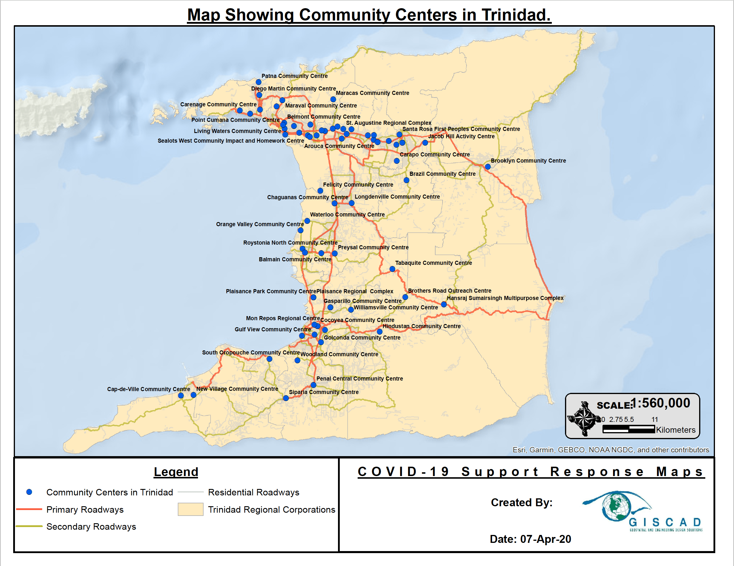
- Community Centers in Trinidad with Labels (png)
- Community Centers in Trinidad with Labels (PDF)
- Community Centers in Trinidad without Labels (PDF)
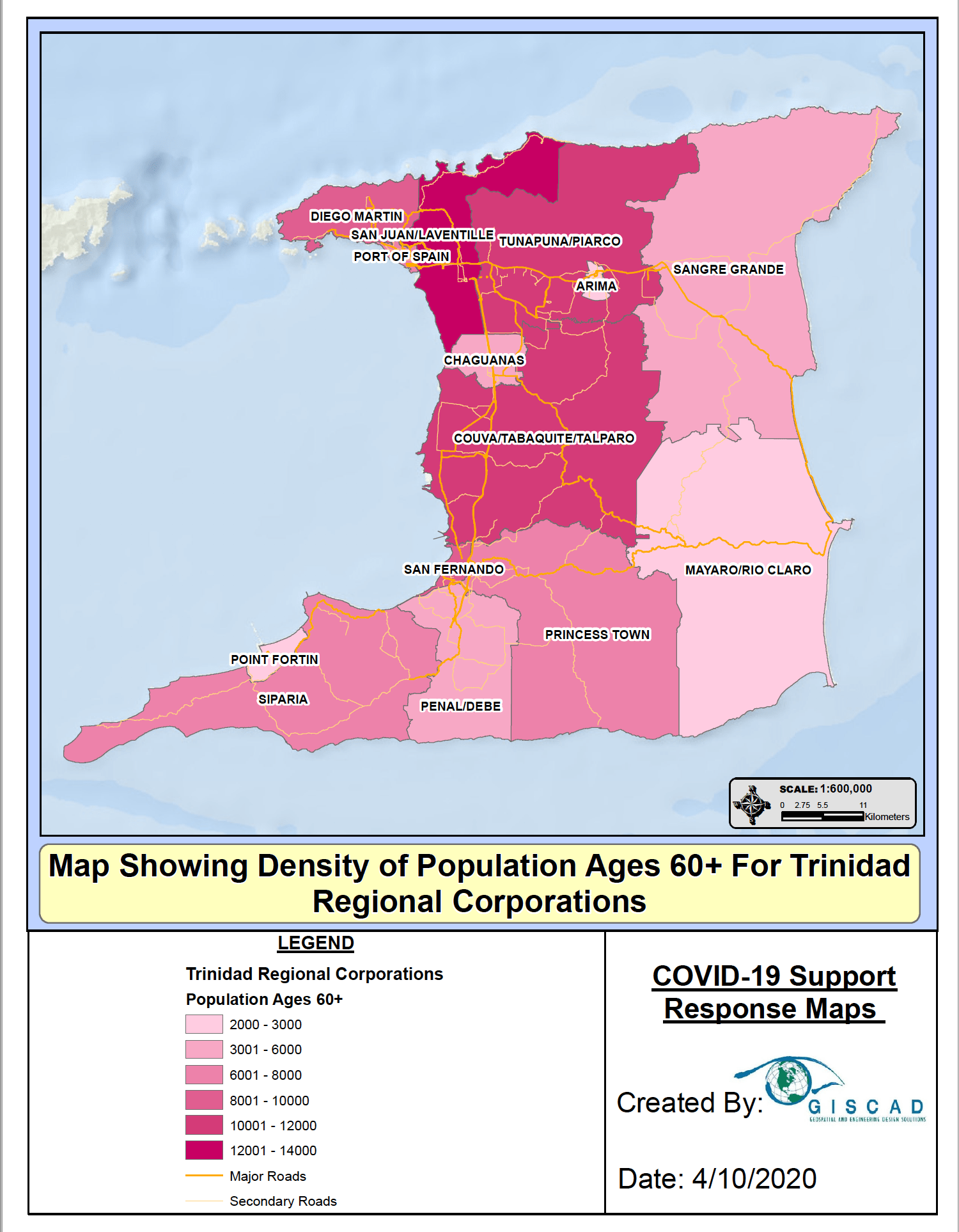
- Density of Population Ages 60+ for Trinidad Regional Corporations (png)
- Density of Population Ages 60+ for Trinidad Regional Corporations (PDF)
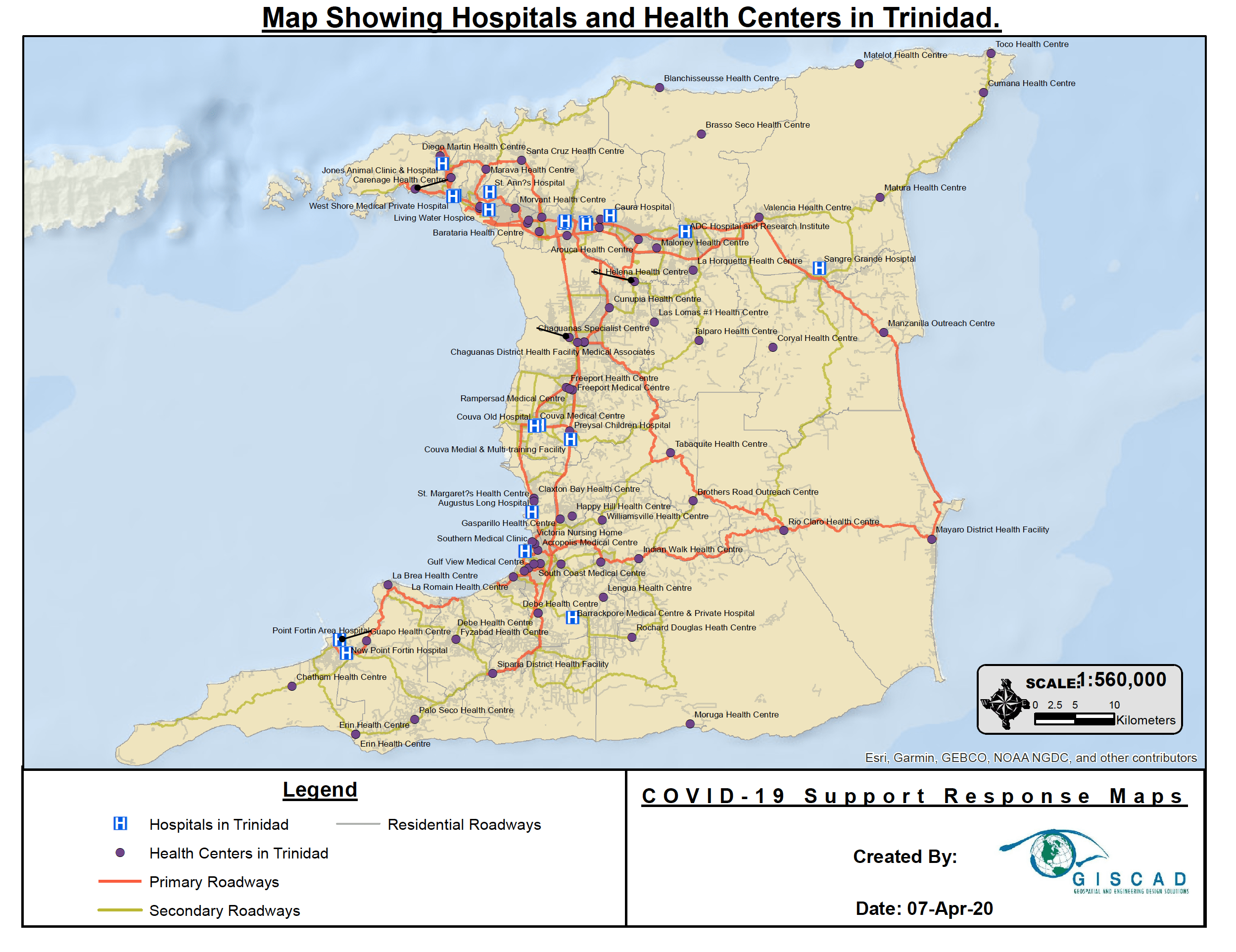
- Hospitals and Health Centers in Trinidad with Labels (png))
- Hospitals and Health Centers in Trinidad with Labels (PDF)
- Hospitals and Health Centers in Trinidad without Labels (PDF)
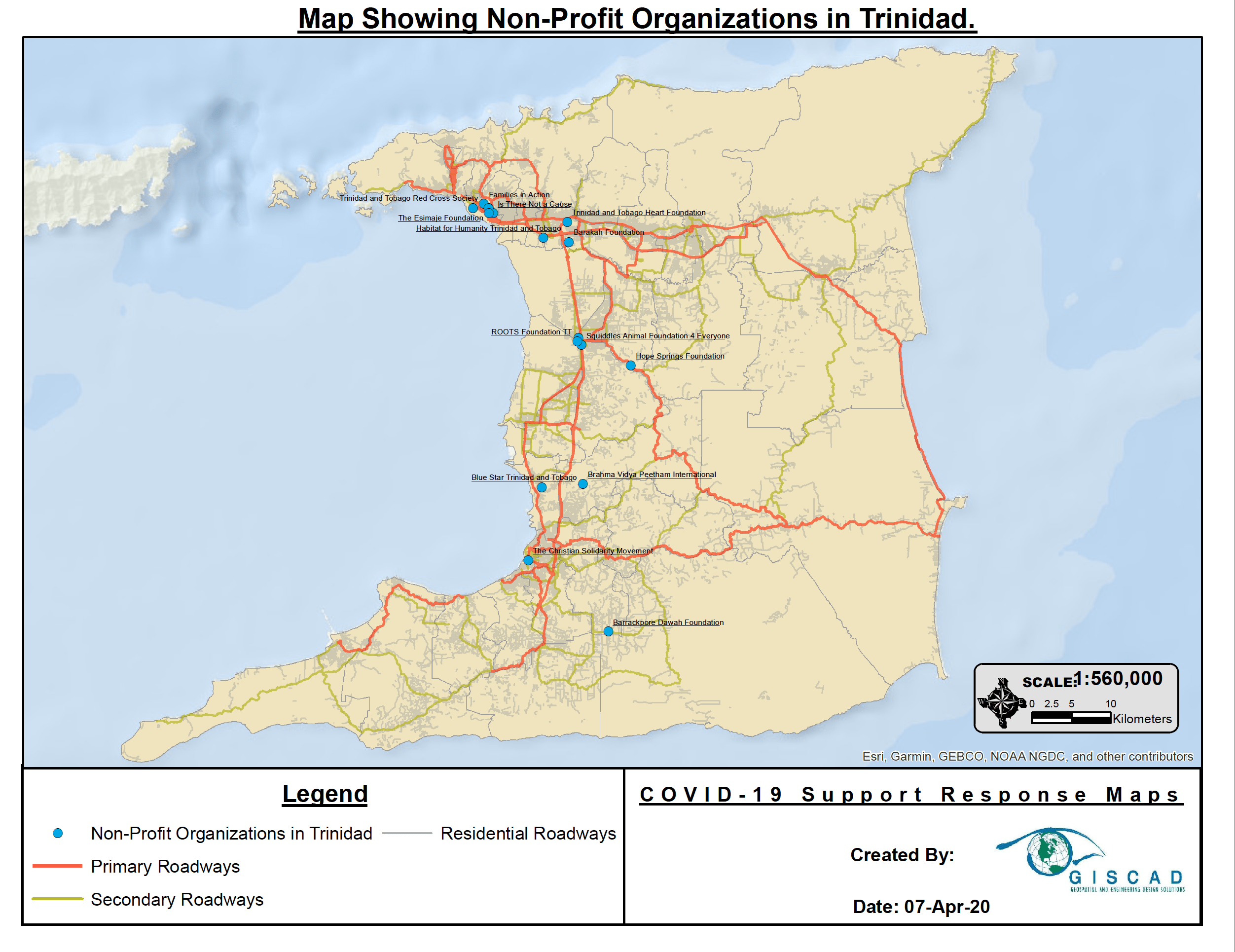
- Non-profit Organizations in Trinidad with Labels (png)
- Non-profit Organizations in Trinidad with Labels (PDF)
- Non-Profit Organizations in Trinidad Without Labels (PDF)
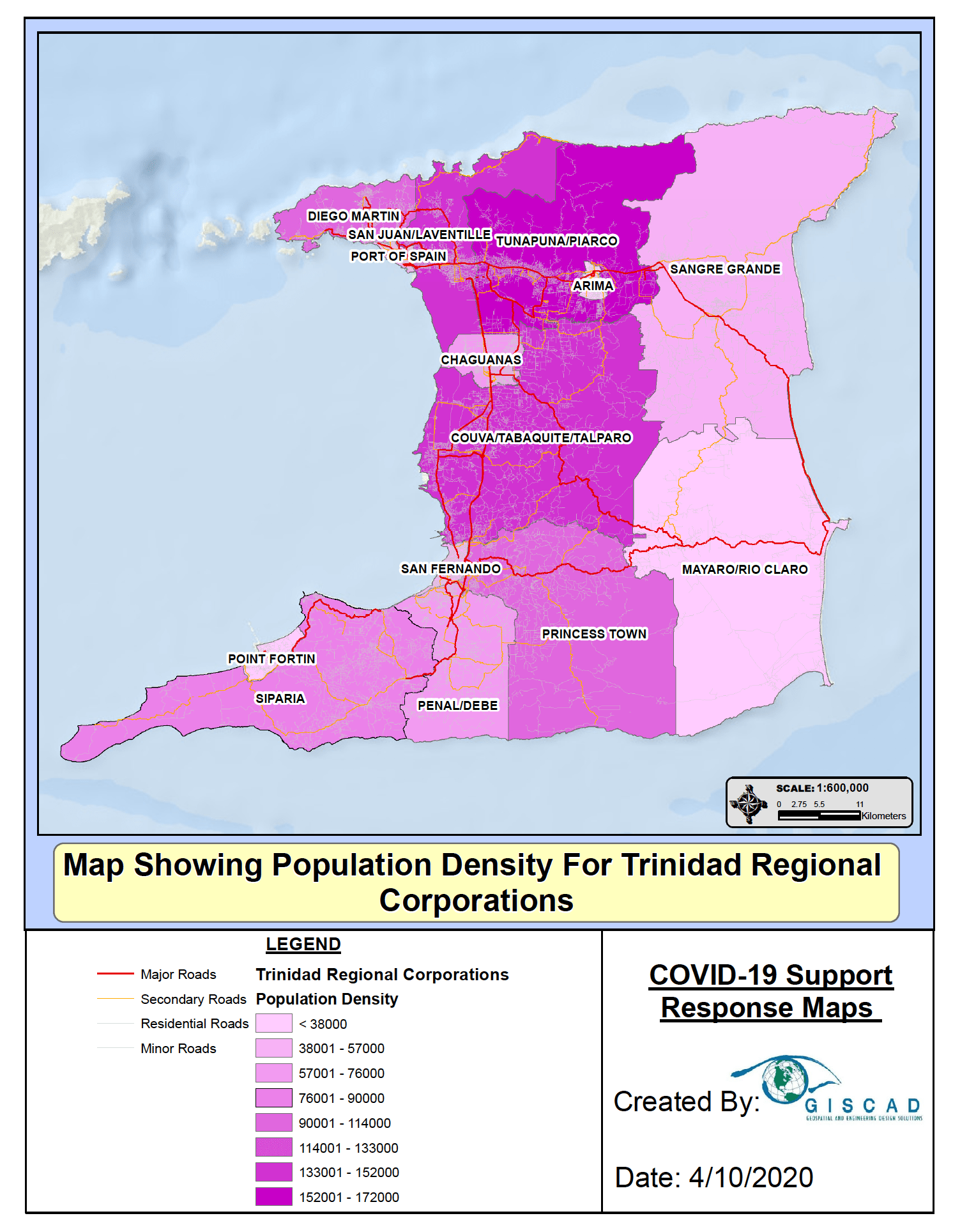
- Population Density for Trinidad Regional Corporations (png)
- Population Density for Trinidad Regional Corporations (PDF)
Trinidad Demographics
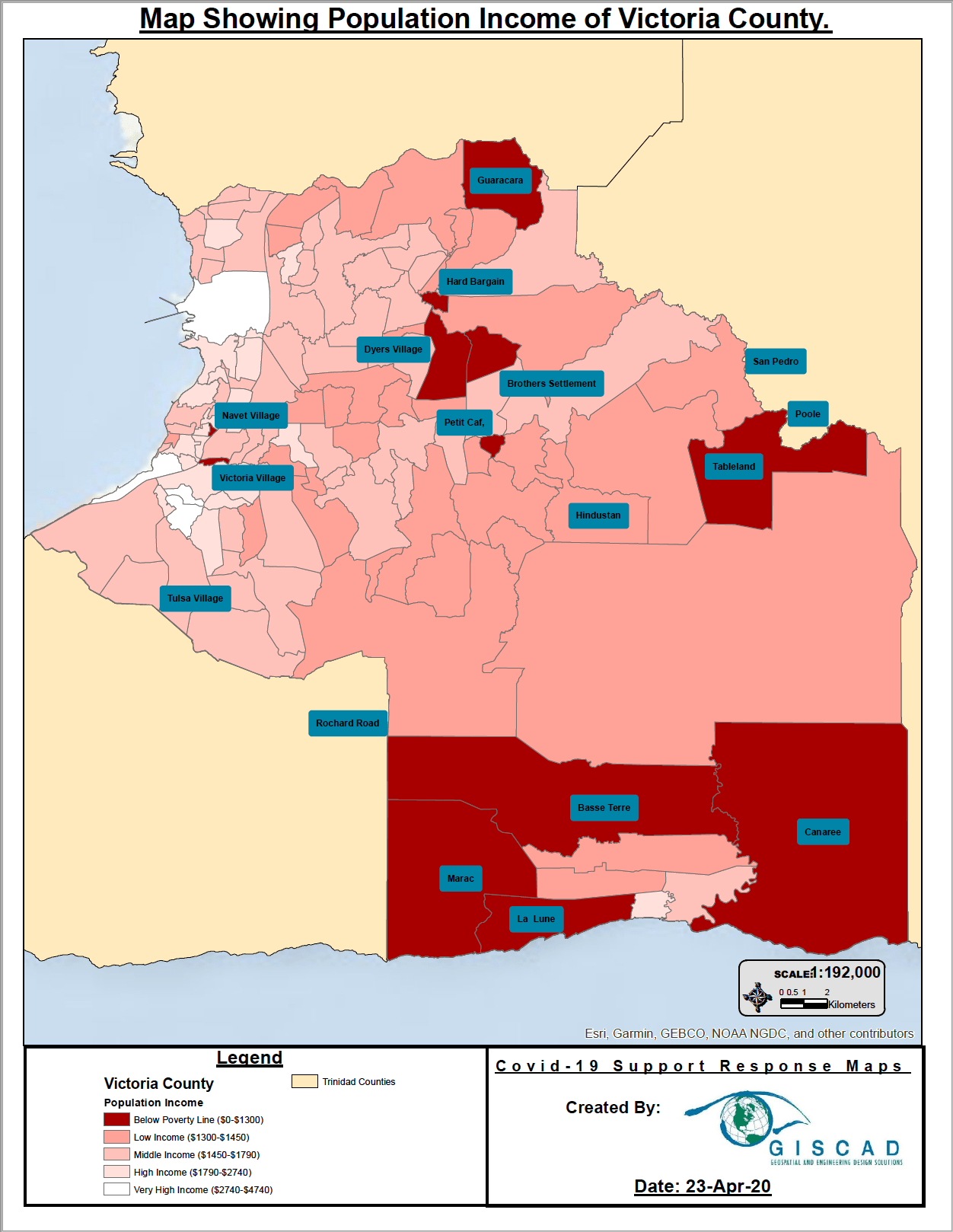
- Population Income of Victoria County (png)
- Population Income of Victoria County (PDF)
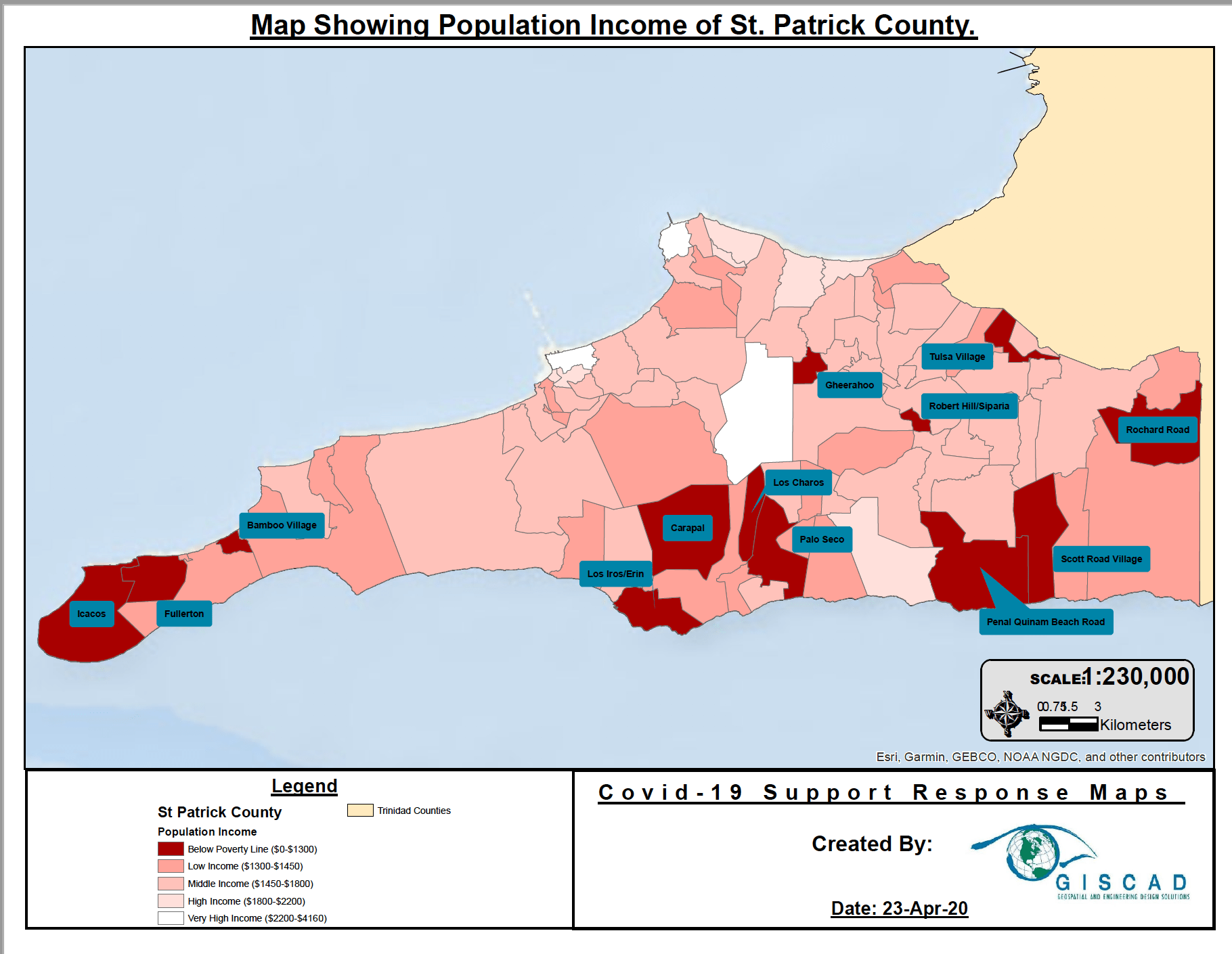
- Population Income of St Patrick County (png)
- Population of St Patrick County (PDF)
- Population Income of St George County (png)
- Population Income of St George County (PDF)
- Population Income of St David County (png)
- Population Income of St David County (PDF)
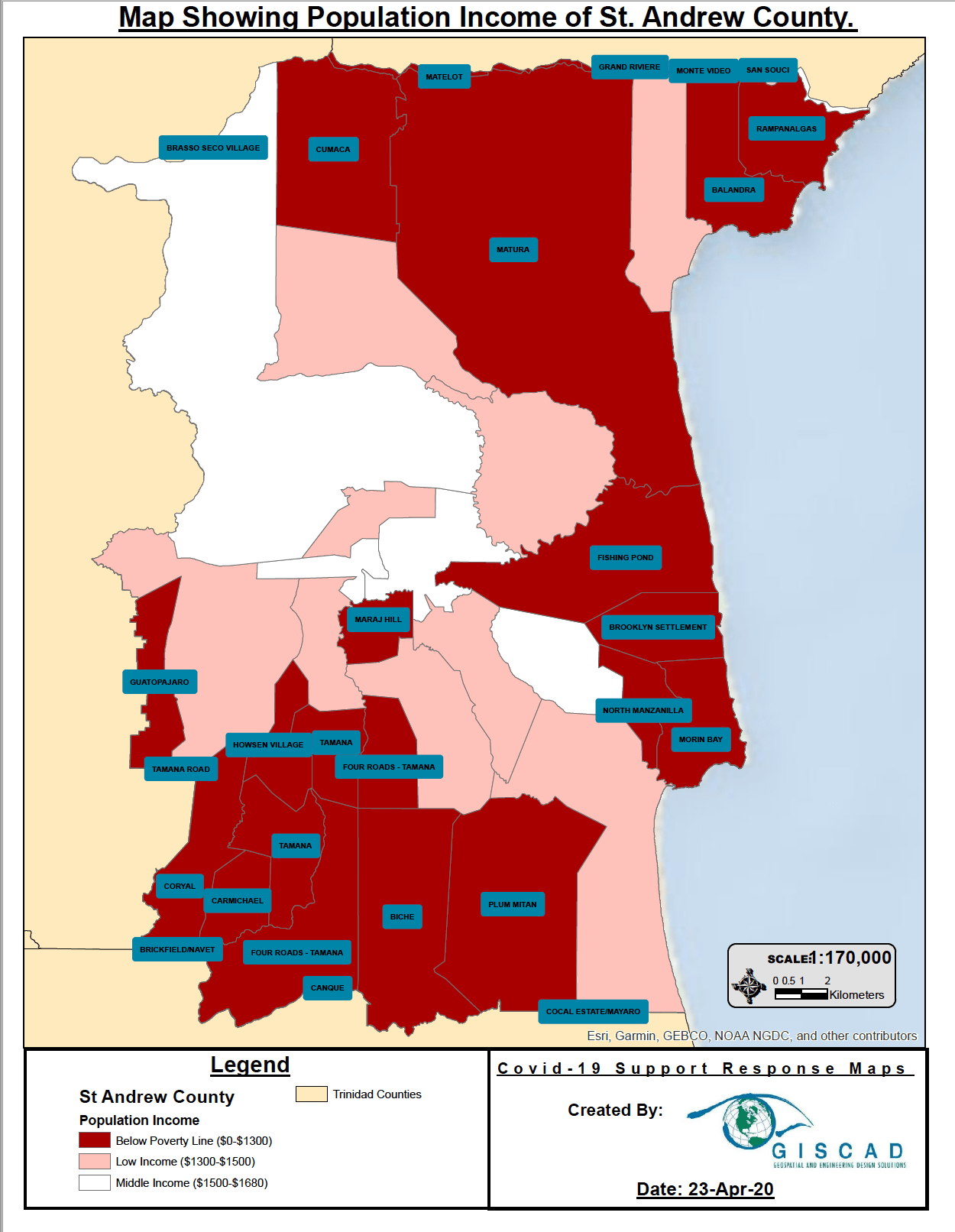
- Population Income of St Andrew County (png)
- Population Income of St Andrew County (PDF)
- Population Income of Mayaro County (png)
- Population Income of Mayaro County (PDF)
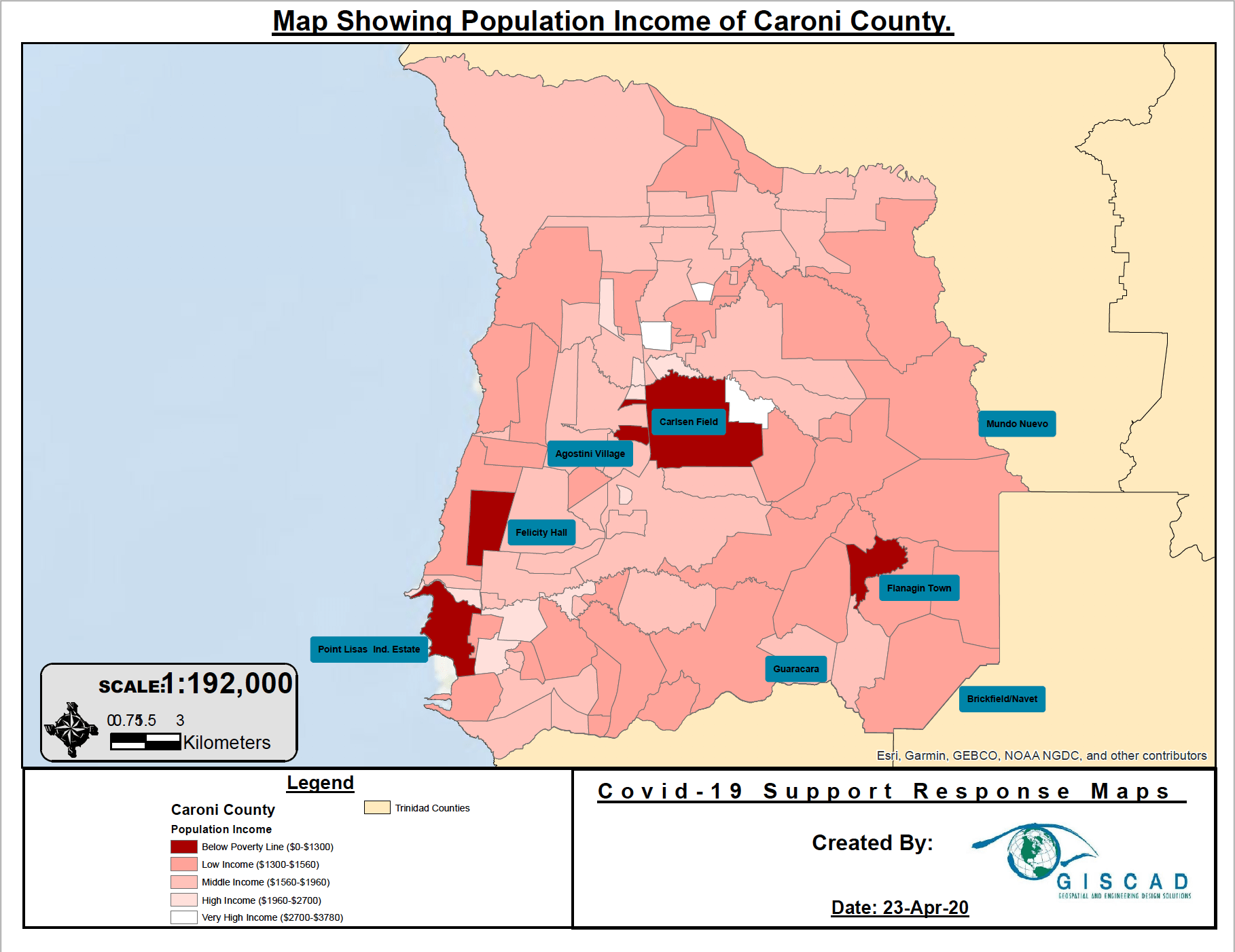
- Population Income of Caroni County (png)
- Population Income of Caroni County (PDF)
Groups audience:


Recent Comments