
User login
Language
Anonymous's groups in this site
User is not a member of any group.
Your groups across all your sites
User is not a member of any group.
Recent Content
Who's online
There are currently 0 users online.
You are here
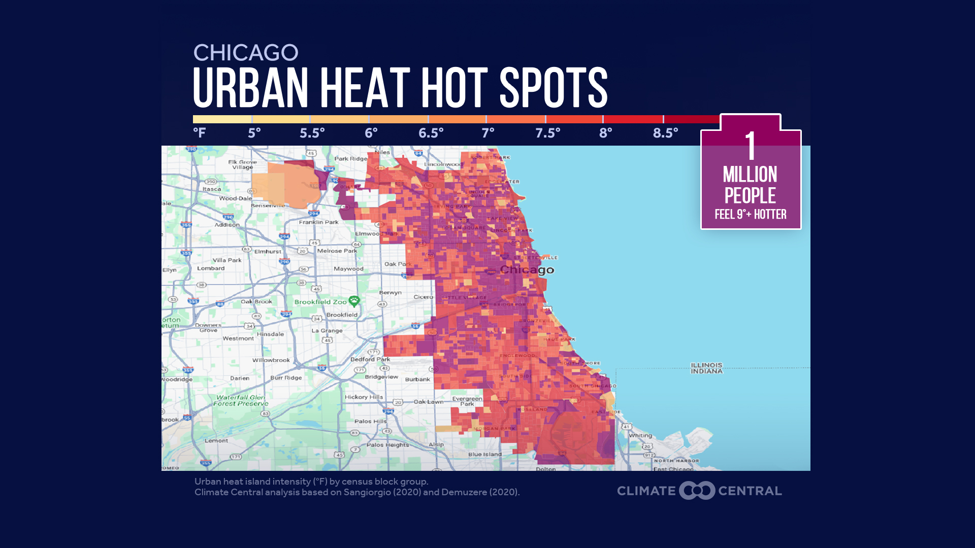
Anaysis of Urban Heat Hot Spots in 65 U.S. Cities
Thu, 2024-07-11 09:20 — mike kraft
-
The urban heat island (UHI) index was calculated for every census block group within each city to estimate how much hotter these areas are due to the characteristics of the built environment.
-
Maps show urban heat hot spots within each city — whether concentrated in the urban core (e.g., Cincinnati) or sprawling across a vast developed area (e.g., Houston).
Country / Region Tags:
General Topic Tags:
Problem, Solution, SitRep, or ?:
Groups this Group Post belongs to:
- Private group -
Recent Comments