
User login
Language
Anonymous's groups in this site
User is not a member of any group.
Your groups across all your sites
User is not a member of any group.
Recent Content
Who's online
There are currently 0 users online.
You are here
COVID-19 Response Support Map Inventory and Needs 4.22.2020
Wed, 2020-04-22 11:02 — Jan BooherNote that this is posted to the Caribbean Resilience System Mapping Work Group due to the international relevance of the maps created, and possible future need for international cooperation within the Caribbean. Please let me know if you think I should create a Mapping Work Group within the Trinidad and Tobago Resilience System as well. I would like to place the Mapping Team individuals into the appropriate Work Group(s) as soon as possible to create an easily accessible institutional record of all maps shared by mapping collaborators.
Jan
I. The following maps were prepared by staff under the direction of Kevin Blake-Thomas ***@***.***, and are currentliy in a gallery on the Trinidad and Tobago Dashboard. Each title below is linked to the image file in the Trinidad and Tobago Media Library. High resolution files are available from Kevin Blake-Thomas.
Trinidad Maps
Community Centers in Trinidad (created with GISCAD - this is a .png file)
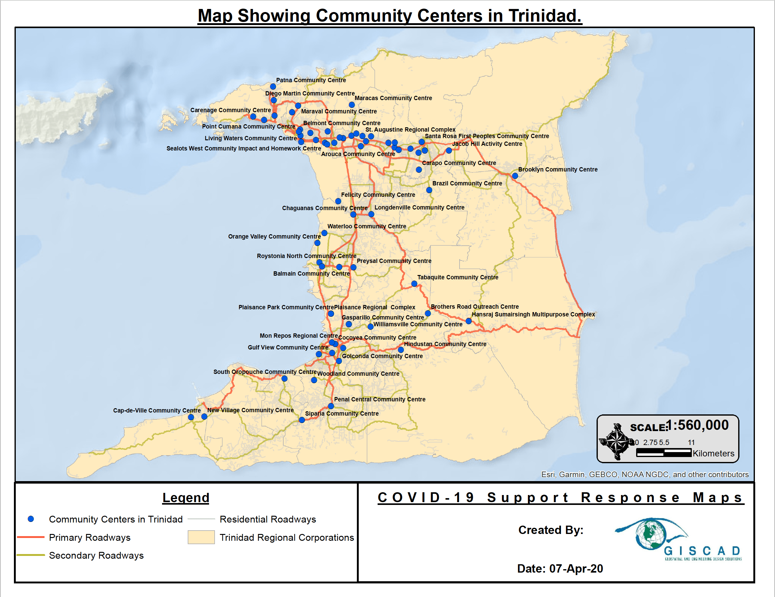
Density of Population Ages 60+ for Trinidad Regional Corporations (created with GISCAD - this is a .png file)
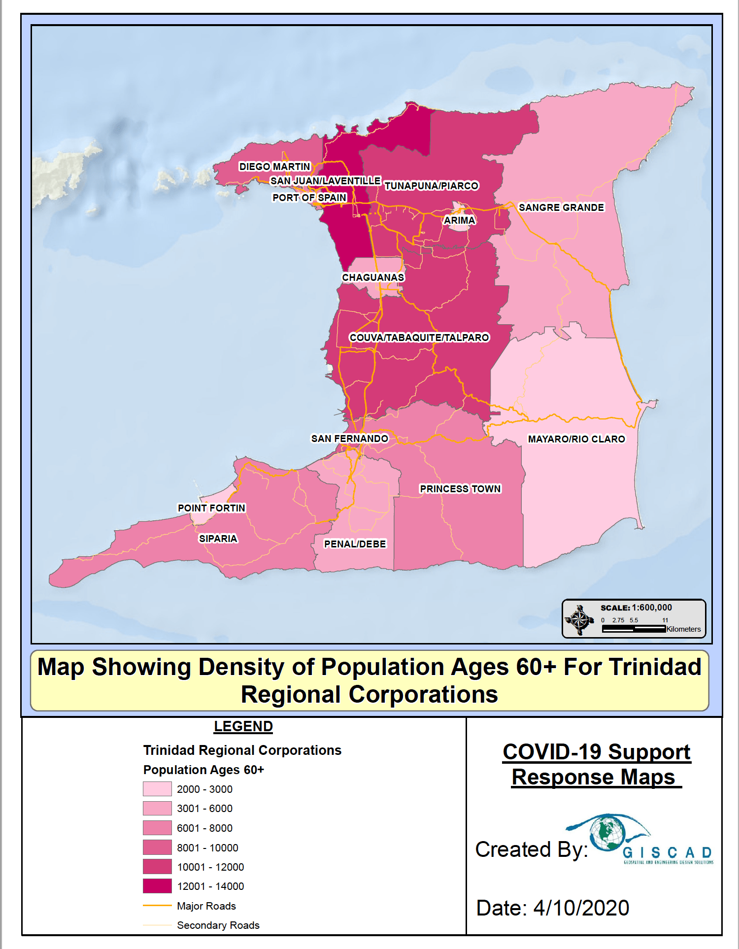
Hospitals and Health Centers in Trinidad (created with GISCAD - this is a .png file)
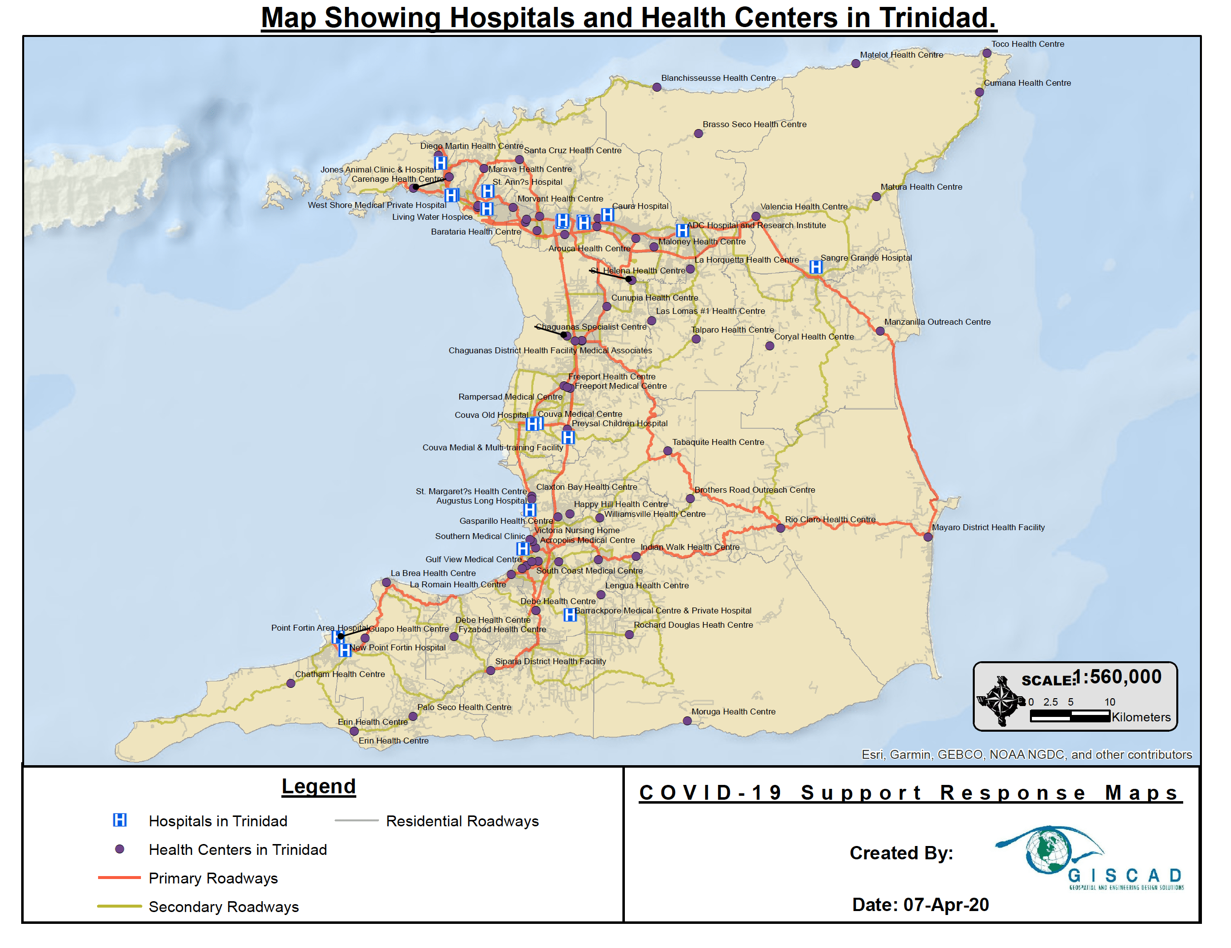
Non-profit Organizations in Trinidad (created with GISCAD - this is a .png file)
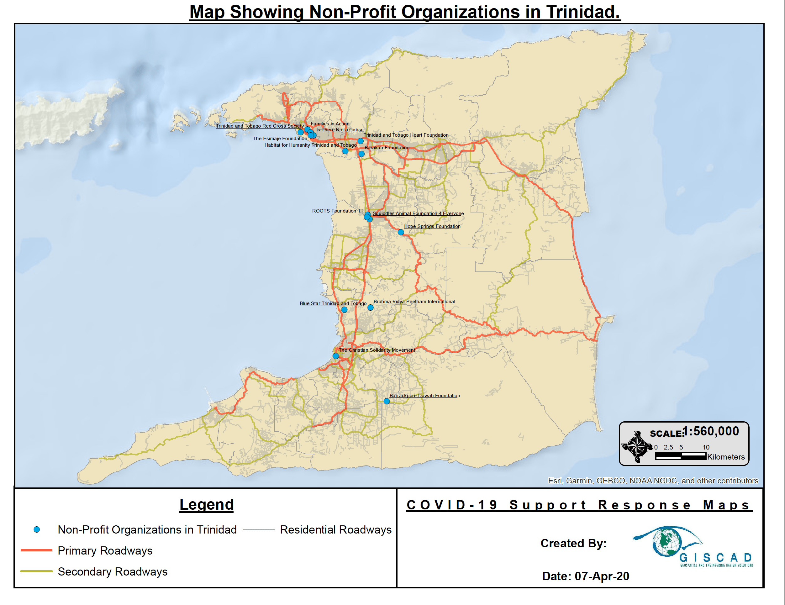
Population Density for Trinidad Regional Corporations (created with GISCAD - this is a .png file)
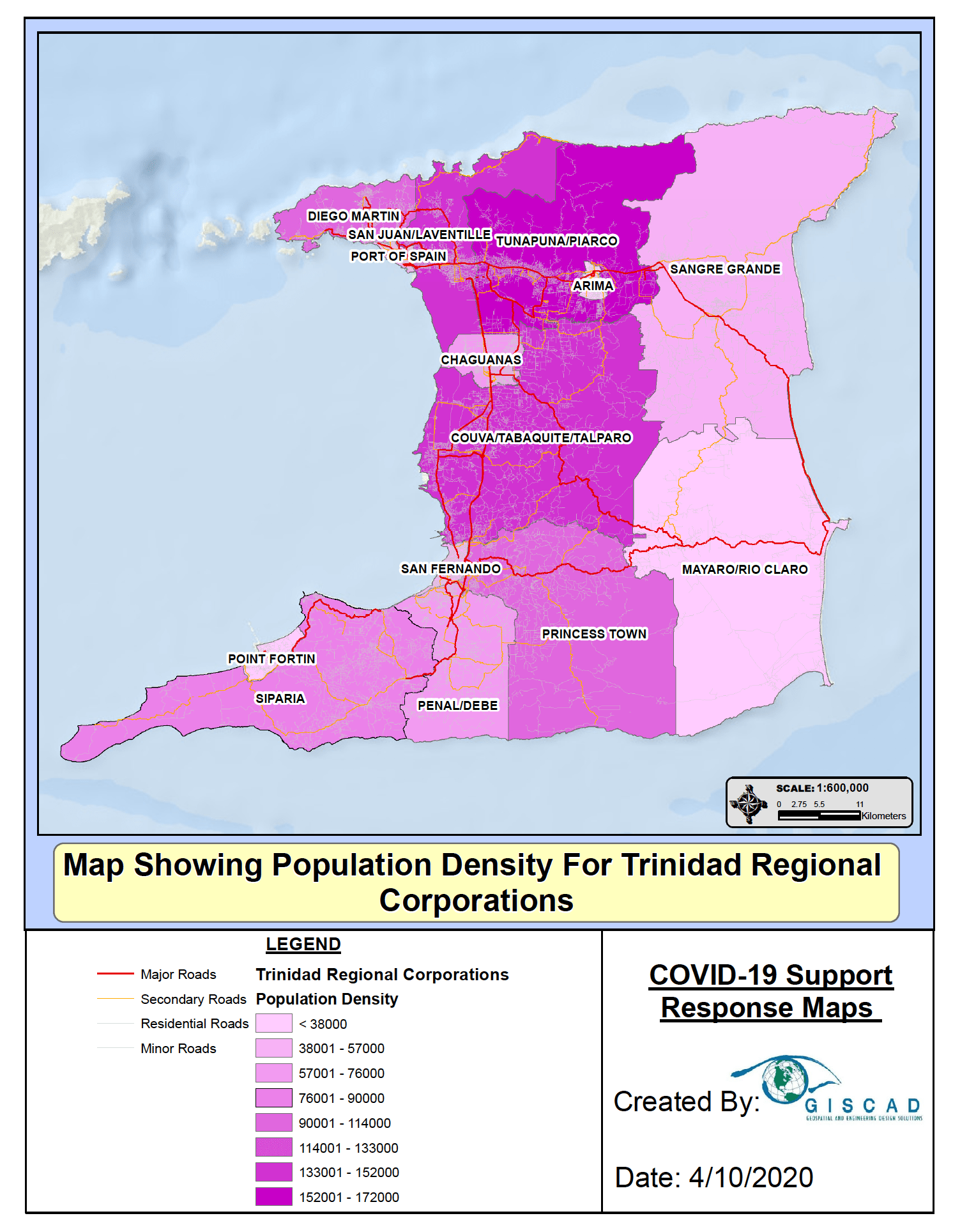
Tobago
Community Centers in Tobago (created with GISCAD - this is a .png file)
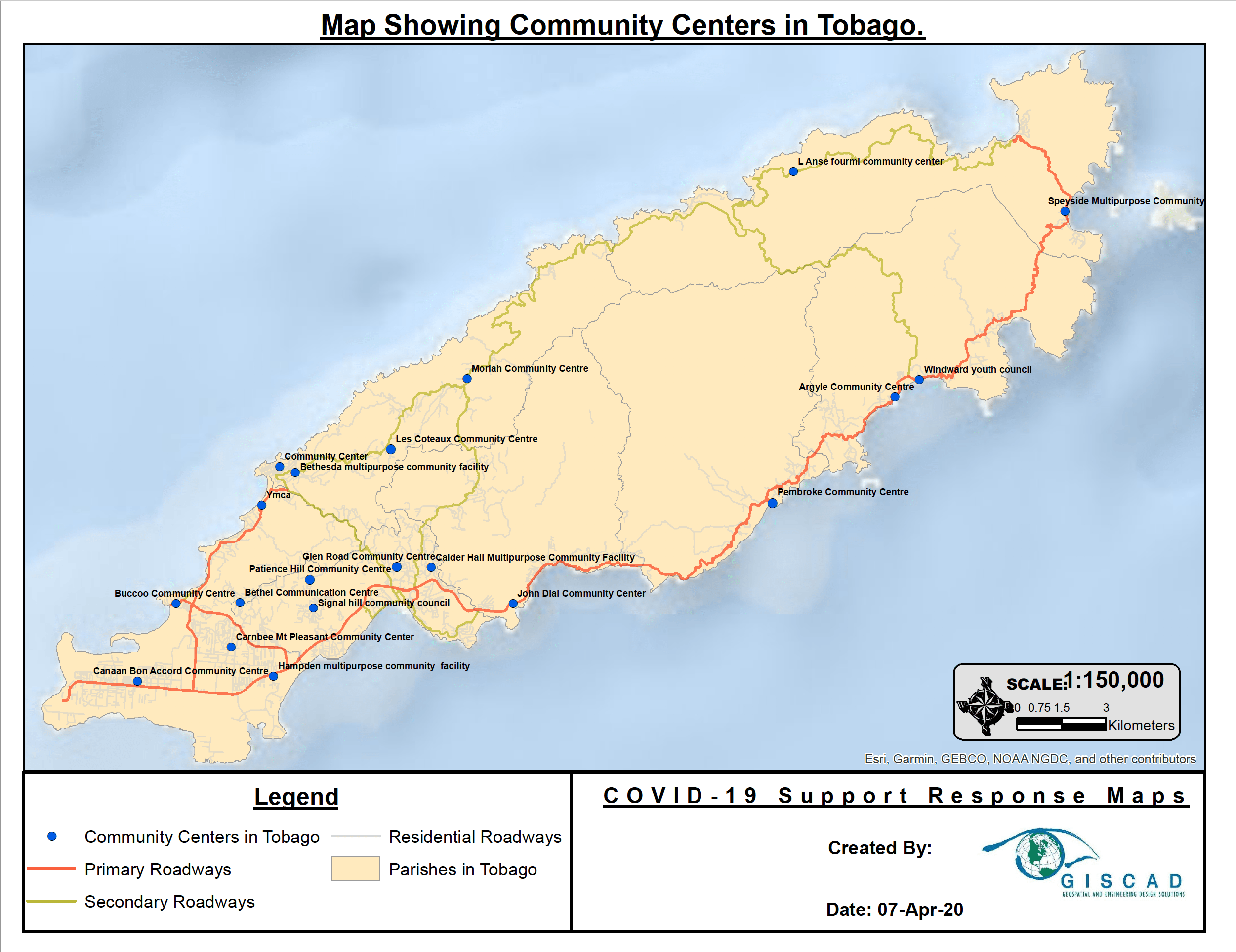
Density of Population Ages 60+ for Tobago Parishes (created with GISCAD - this is a .png file)
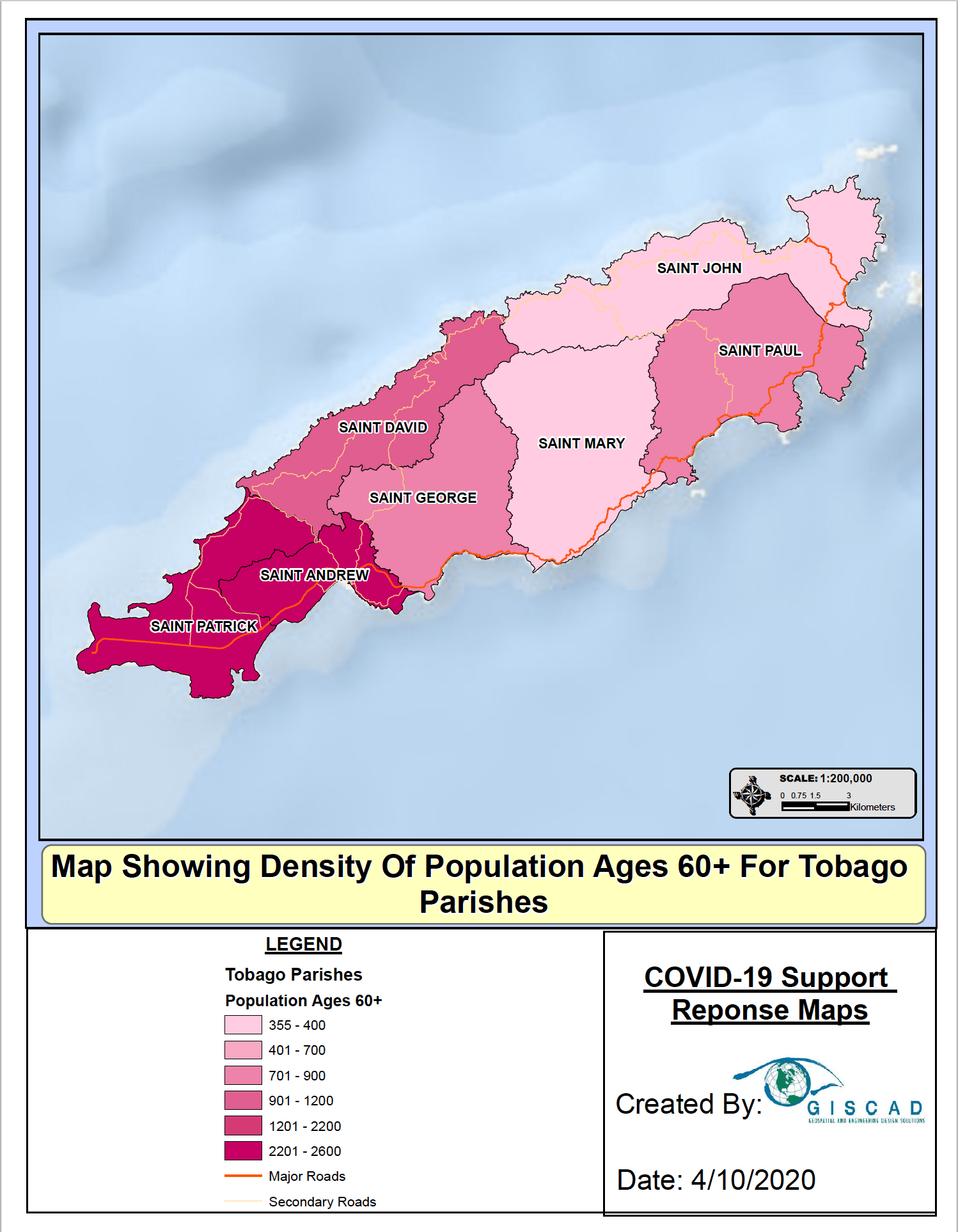
Hospitals and Health Centers in Tobago (created with GISCAD - this is a .png file)
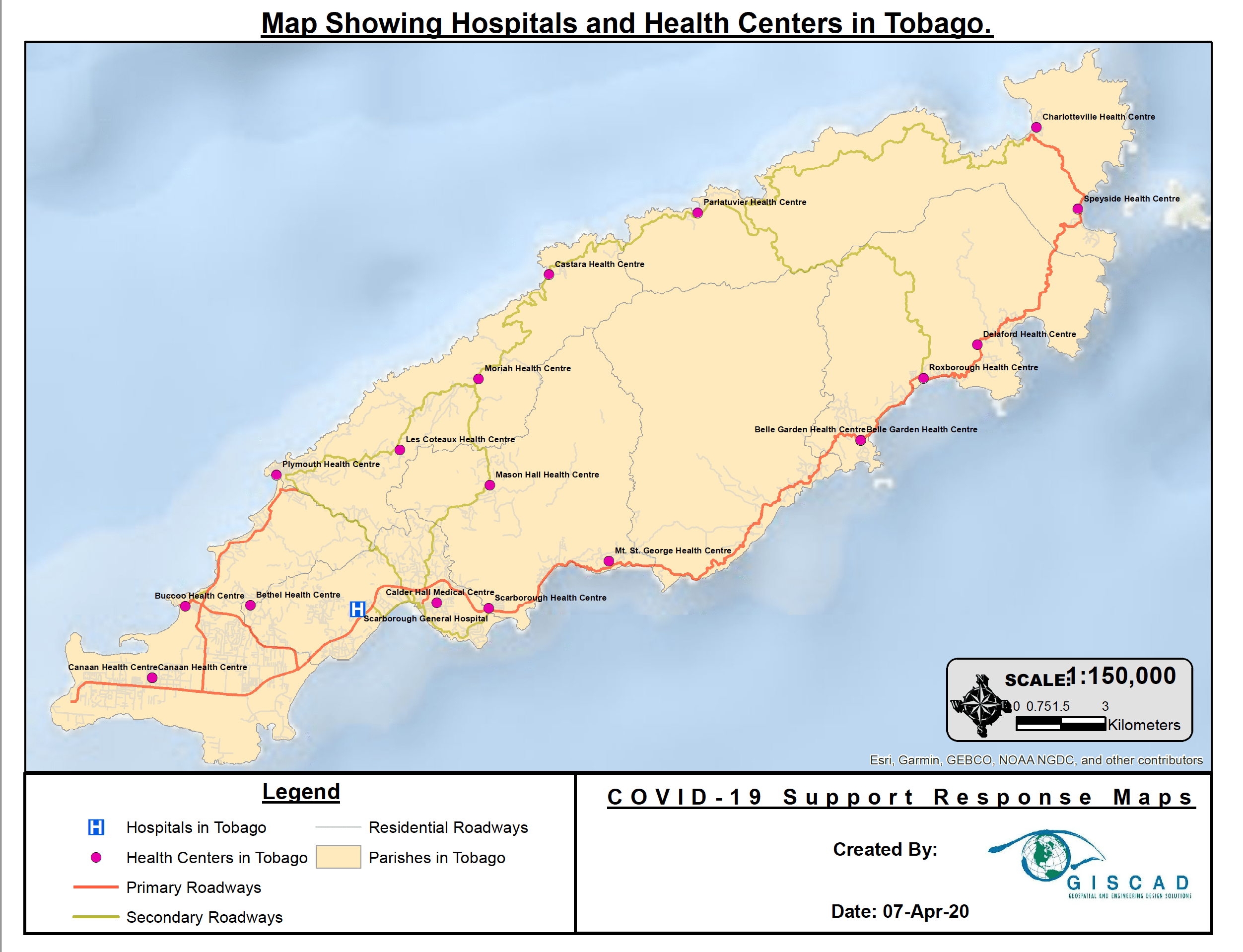
Population Density for Tobago Parishes (created with GISCAD - this is a .png file)
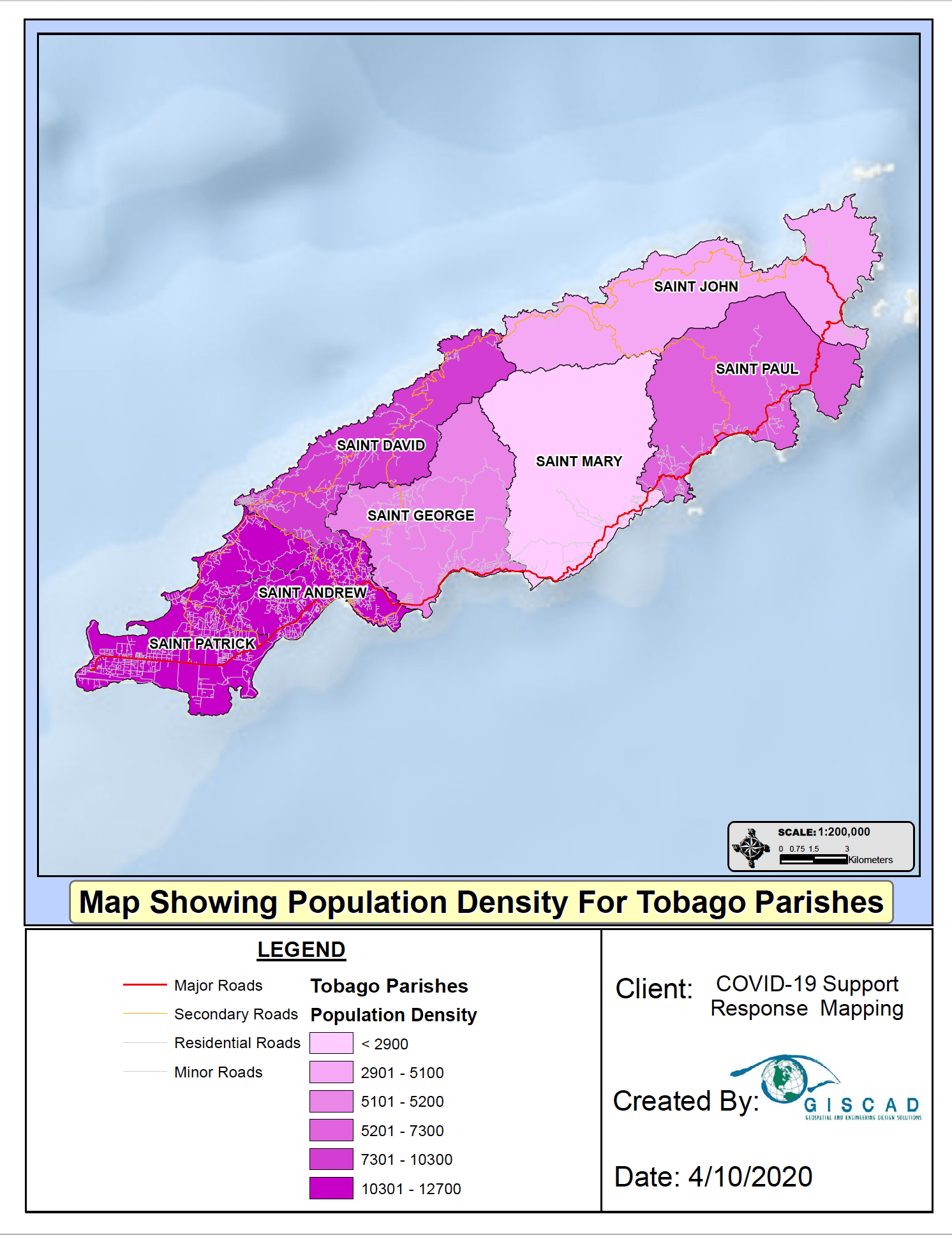
II. The following map is an interactive layered conceptual map to demonstrate the layered aggregation of health service data with the service centers that exist to address those cases.Map layers include: 1)Regional Corporation Polygons colored to reflect 4/1COVID Case Data and 2)Hospitals and Health Centers.
Trinidad and Tobago
Health Resource Map Trinidad and Tobago -created in Google Maps (Jan Taylor is owner, Kevin Blake-Thomas and webmasterMPHISE are shared in as collaborators on the map. This map, which is under construction, needs to be reviewed for accuracy of the healthcare facilities, which facilities should be included on the map, and tobe reviewed to establish that the information is current.
III. Maps Existing or Needed in support of the Social Needs Committee:
The following maps have been identified as needed by Project Manager Deeanna Burleson in conversation with the Archdiocesan Ministry for Migrants & Refugees.
- Poverty Map -Existing - to be provided by OPPD Gary Tagallie ***@***.***
- Community Resilience Capacity Zone map with boundaries of parishes (Tobago) and counties (Trinidad)-Needed
- Food Resources map-Needed
- The completed Health Resource Map for Trinidad and Tobago-Needs to be finished
Recent Comments